Day 9 Until Next Time

We were on the water a little after 7 am headed for Charleston Tennessee.  Most days, I was more spontaneous and less focused, but today I was on a mission. I was ready to see my family.

image

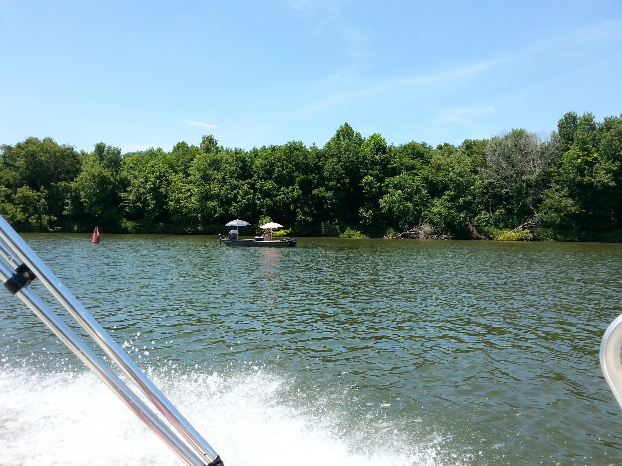
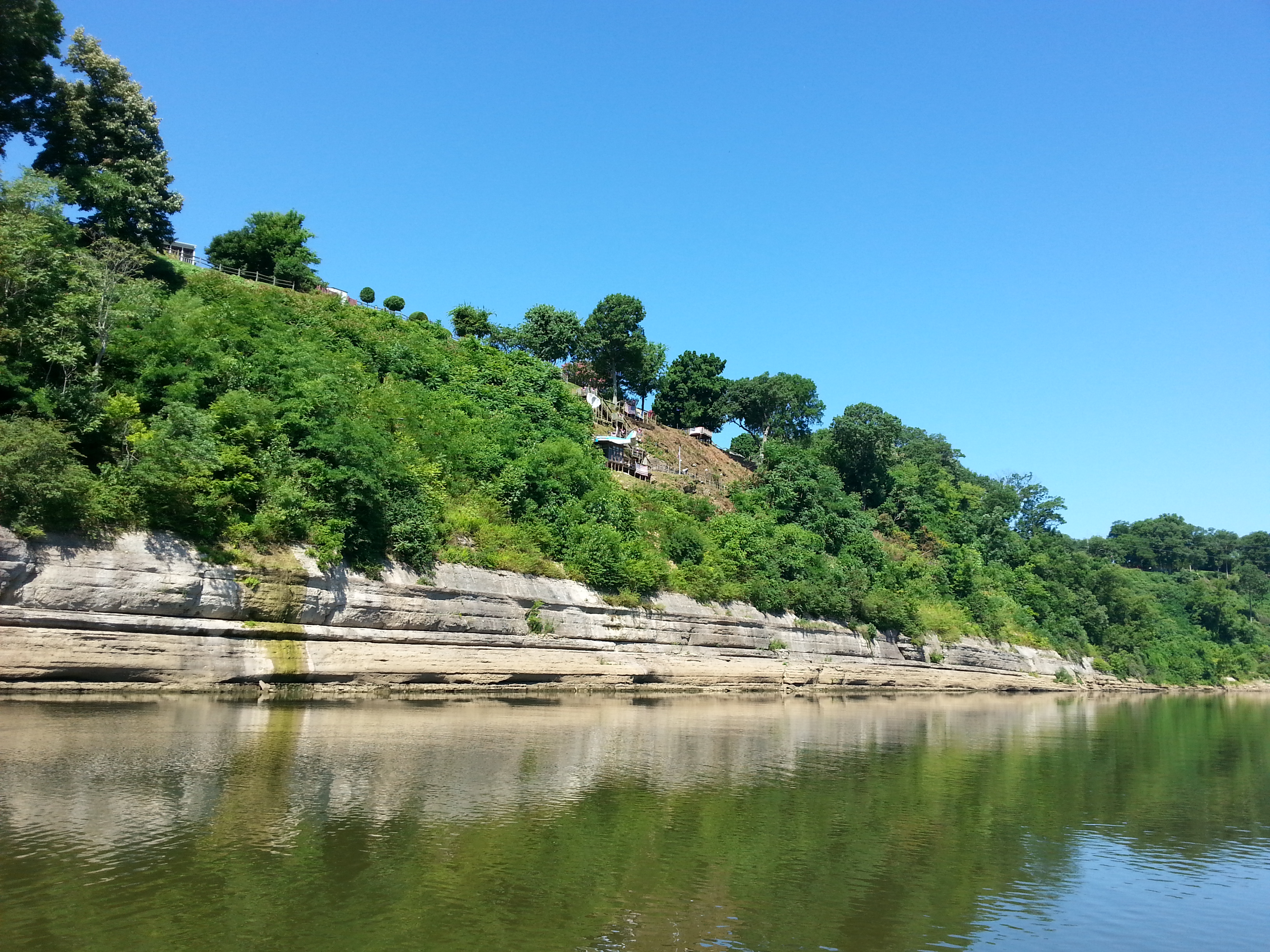
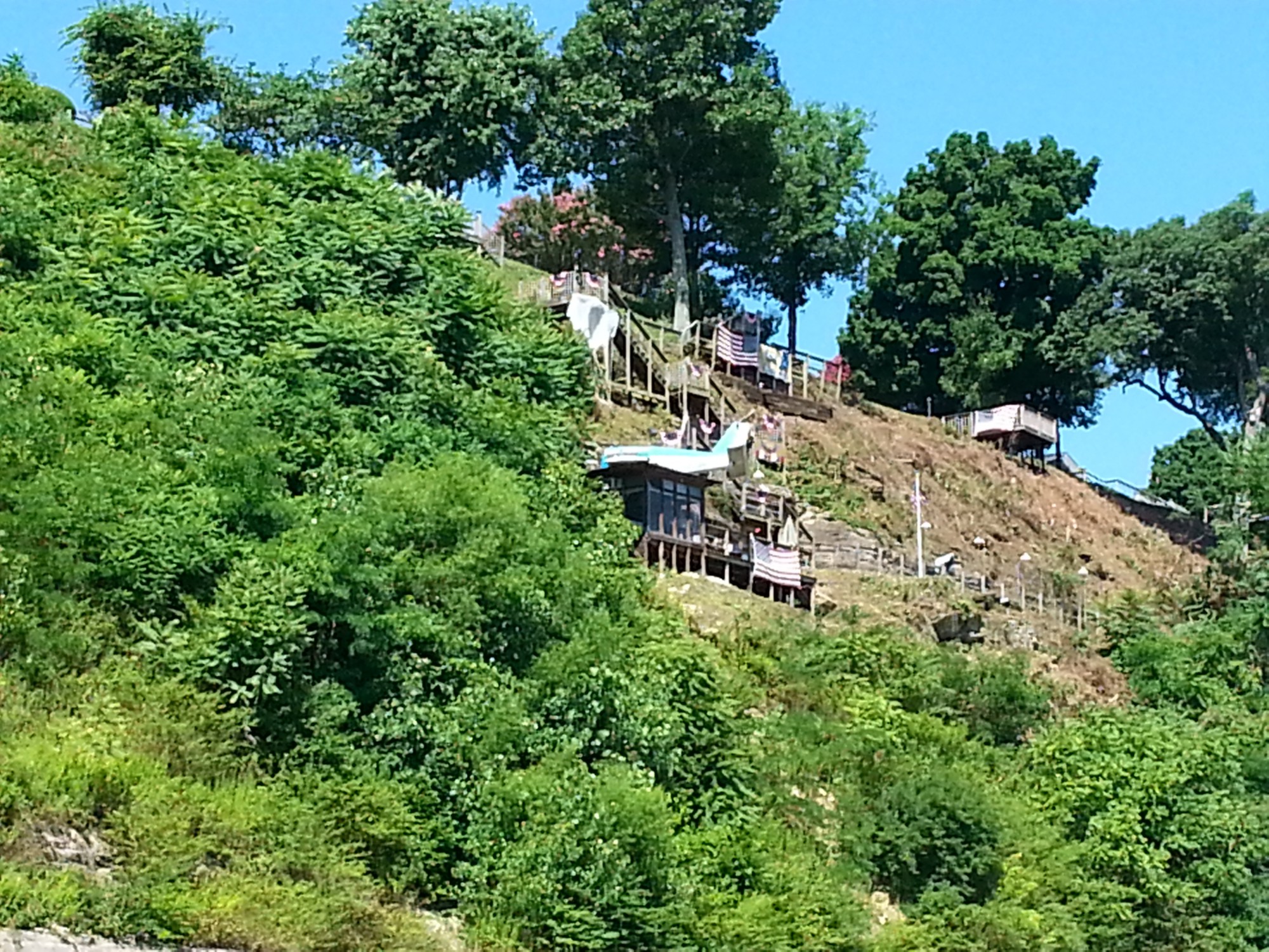
The Tennessee River Gorge just outside of Chattanooga is the most scenic section of the Tennessee River in my opinion. You have Signal Mountain on one side and Lookout Mountain on the other. A handful of pictures that I took just do not capture the beauty of this place. If you ever get the opportunity I would encourage you to go see for yourself. You can rent boats, kayaks, or take a tour boat out of Chattanooga into the gorge.

image

image

image

image

This unassuming facility in the side Raccoon Mountain is a pump storage facility operated by TVA. You can read more about it here http://www.tva.gov/heritage/mountaintop/

image

Tennessee Aquarium tour boat headed into the gorge.

Downtown Chattanooga has the most beautiful and accessible riverfront of all the cities that I passed through on this 900 mile trip. You can dock your boat at the courtesy docks and within a short walk you can be at the Aquarium, museum, restaurants, and shops.

image

image

image

image

Courtesy docks downtown Chattanooga.

image

The bridge in the foreground is a pedestrian walking bridge.

image

Hunter Art Museum is one of my favorite downtown attractions.

image

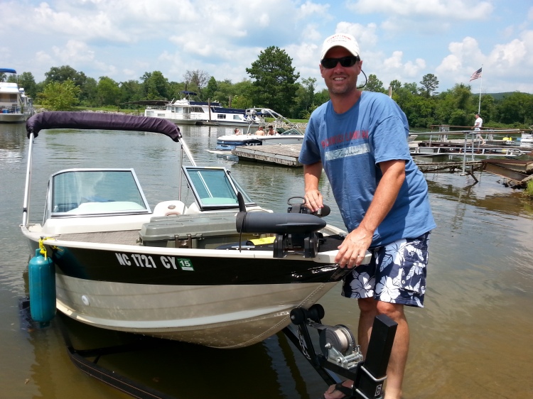
My brother-in-law Evan. This is the last lock of the trip onto Chickamauga Lake.

image

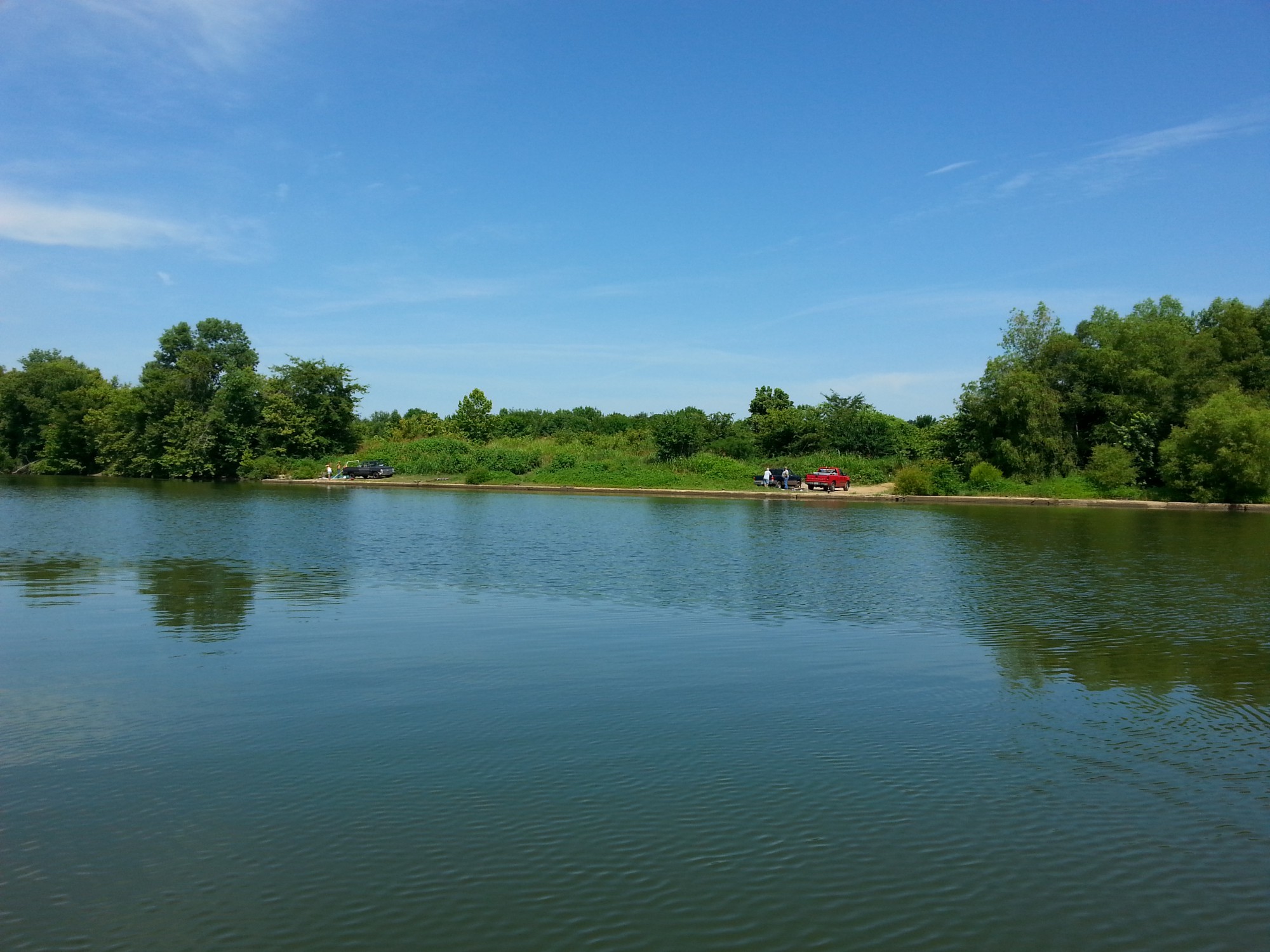
Pulling the boat out of a water after completing the 900 mile adventure.Would I do it again? Absolutely.

image

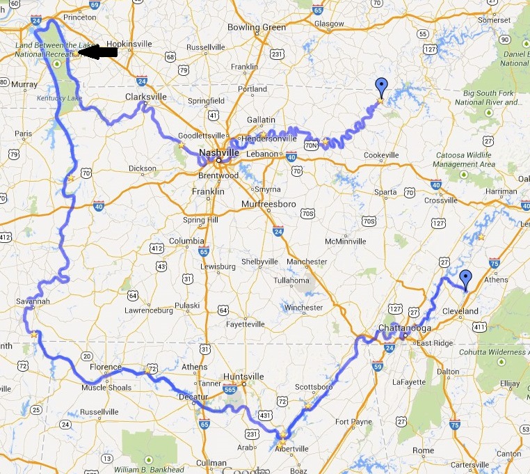
Today we traveled roughly 75 miles. We turned off of the Tennessee River on to the Hiwassee River at mile marker 499.

The Tennessee River continues on to Watts Bar Lake and then onto Ft Loudon. I have been on these lakes numerous times so I ended my trip on the Hiwassee River.

Thank you so much to all my family members who were awaiting my arrival in the scorching sun this afternoon. I was surprised to say the least. Thank you!

Speaking of surprises. It only rained one day out of the nine on this trip. July in the south, that is rarer than rare…. Of the nine locks that I travel through on the Cumberland in Tennessee rivers my longest delay was 45 minutes at Pickwick lock. With all the commercial traffic it takes place up and down these rivers this too is rarer than rare….

image

The end… Until next time…

image

image

Chickamauga Reservoir
Chickamauga Reservoir is named for a tribe of Native Americans that broke away from the Cherokee Nation in the 1700s. They lived in villages along North Chickamauga Creek, which joins the river just below Chickamauga Dam. The reservoir is popular for fishing, boating, and swimming. There are boat ramps on the reservoir and canoe access on North Chickamauga Creek.

The Big Ridge Small Wild Area is a 200-acre upland hardwood forest situated on a high ridge above the north shore of the reservoir at the dam. An easy 1.3-mile loop trail leads through the forest. Spring wildflowers include bloodroot, toothwort, larkspur, trillium, and mayapple.

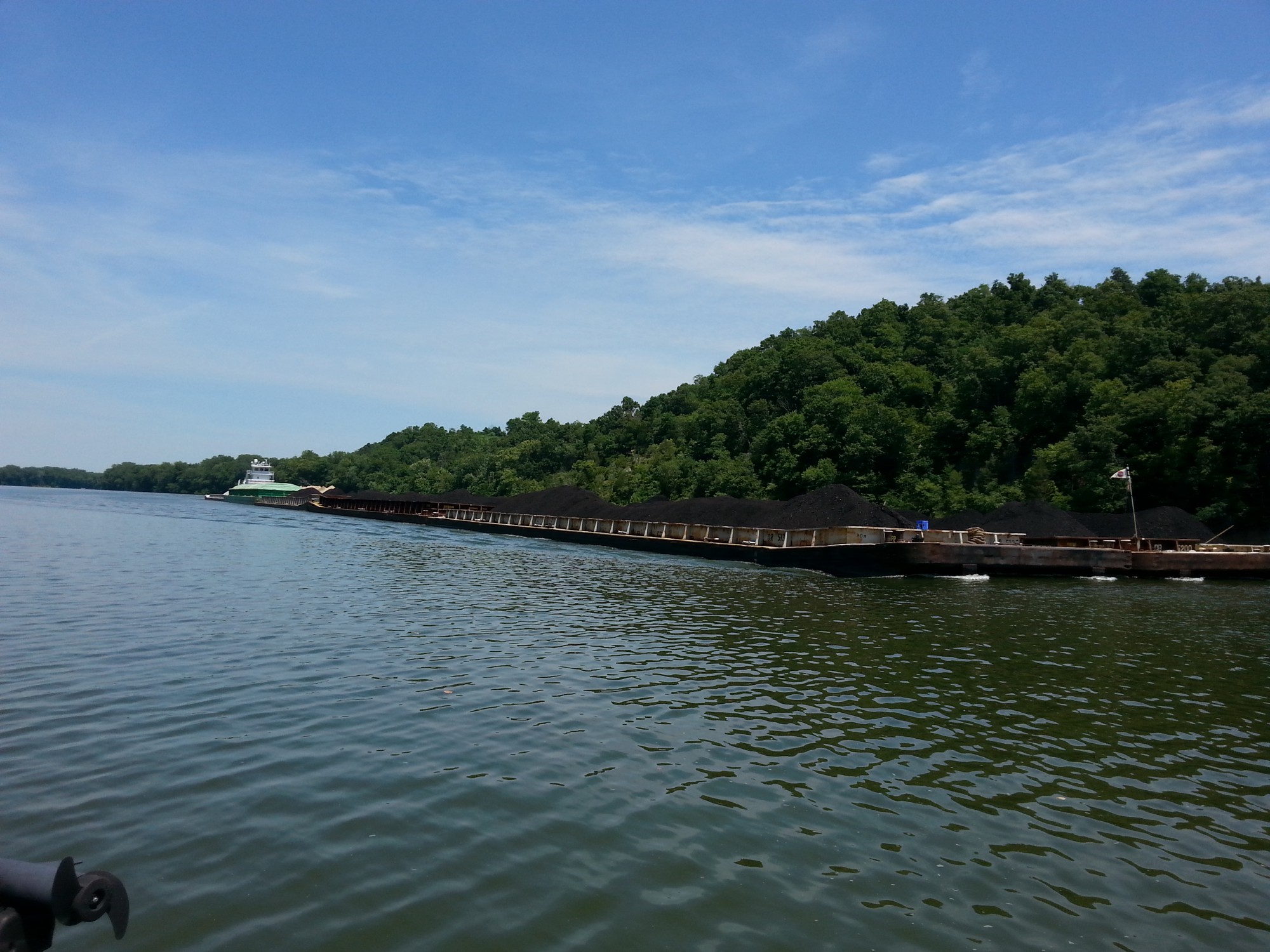
Before TVA created Chickamauga and other reservoirs above Chattanooga, the city had one of the most serious flooding problems in the nation. Now the river that often threatened the city contributes to its economy as a major artery for barge traffic.

Day 8 Hop Skip and a Jump

We left Goose Pond this morning headed to Nickajack Lake. I still can not believe that the weather has been this good for this many days. It was great having a co-pilot today enjoyed catching up.

I think I have became a true river rat.

image

We seen a small fawn. Wish I would’ve had a real camera. I’ve been doing the entire blog on my cellphone.

image

image

Couple more bridges.

image

Banks of lower Nickajack. The river really changes once you get up on Nickajack.

image

Lunch on the water.

image

Hales Bar Dam was a hydroelectric dam once located on the Tennessee River in Marion County, Tennessee, United States. The Chattanooga and Tennessee River Power Company began building the dam in 1905 and completed it in 1913, making Hales Bar one of the first major multipurpose dams and one of the first major dams to be built across a navigable channel in the United States.

In 1939, the Tennessee Valley Authority assumed control of Hales Bar Dam. TVA spent two decades trying to fix a leakage problem that had plagued Hales Bar since its construction, but after continued leakage, and after it was determined that expanding the dam’s navigation lock would be too expensive, TVA decided to replace the dam by building Nickajack Dam 6 miles downstream in 1968.

image

Hales Bar Marina rents these small floating houses.

image

image

Tonight we are staying in the Tennessee river gorge about 25 miles south of Chattanooga. No we do not have this whole house to ourselves. The owners live on site and rent a loft apartment or a single unit. My wife and I had stayed here last summer. Great location on a scenic section of the river.

image

image

image

image

Today we traveled approximately 65 miles.  Close…. Real close…..

image

Nickajack Reservoir
Nickajack Reservoir extends 46 miles upstream from the dam to Chickamauga Dam. The reservoir offers wide expanses of water and the spectacular scenery of the Tennessee River Gorge, known as the Grand Canyon of Tennessee.

Boat-launching ramps and fishing berms are located on both sides of the river below the dam, and a concrete fishing pier with footbridges and a wheelchair ramp is available. TVA camping and picnicking facilities are also available.

Between late April and early October, nearby Nickajack Cave serves as habitat for roosting gray bats, an endangered species. At dusk, the sky is darkened as thousands of bats emerge from the mouth of the cave.

Nickajack is the sixth step in the stairway of TVA reservoirs and locks that carry barges up and down the Tennessee River.

Day 7 Got The Blues

I left Joe Wheeler State Park this morning headed for Guntersville Lake.
The sunrise was spectacular.
image

image
Leaving the State Park.

image

image
Adjacent to the main lodge, the park rents cabins right on the lake. I would like to come back with my family one day.

image
Decatur Alabama was my next stop. Looks like they are starting to develop a riverfront area.

image

image

image
The Pickwick Belle

image

image
I was under this very low bridge taking some pictures when…

image
This train comes flying by. I don’t think that I have ever been so close to a moving train.

image
No hungry cats around here.

image
How often do you get to sunbathe while driving

The stretch of Wheeler Lake from Decatur up to Guntersville was a trip highlight.
image

image
Neat natural bridge.

image

image

image

image
See what I meant about having blues. The weather has been absolutely gorgeous.

image
I was able to quickly lock through onto Guntersville Lake.

image
One of the things I have noticed about Guntersville Lake is that all boat houses have full doors. Most be code.

image

image
My brother in law Evan came down to Scottsboro, AL and met up with me today. We don’t get to hangout as often as I would like. Excited to have a copilot for the remainder of the trip. We are staying at Goose Pond Colony. I forgot to take a photo, so I will use one of theirs.
image

I traveled 100 miles today. Then when Evan arrived, we ran back down river 20 miles and had dinner at a popular seafood restaurant in Guntersville Alabama.

image

I have also included some general information about the lakes that I traveled on today. This information came from TVA.

Wheeler Reservoir
Wheeler Reservoir is one of nine reservoirs that create a stairway of navigable water on the Tennessee River from Knoxville, Tennessee, to Paducah, Kentucky. Along with Wilson and Pickwick reservoirs downstream, Wheeler helps cover the Muscle Shoals, the rock formations that had blocked navigation on the Tennessee River.

Today, Wheeler Reservoir is a major recreation and tourist center. Along with camping, boating, and fishing, visitors enjoy the Wheeler National Wildlife Refuge several miles upstream from the dam. The refuge features Alabama’s only significant concentration of wintering Canada geese.

Barge traffic on Wheeler has made it one of the major centers along the Tennessee waterway for shoreline industrial development. Private industry has invested about $1.3 billion in the waterfront plants and terminals at Decatur, Alabama, the largest city on the reservoir.

Guntersville Reservoir
Good fishing, clear waters, and the beautiful backdrop of the wooded Appalachian foothills combine to make Guntersville one of the South’s premier recreation attractions.

Crappie is the number-one sportfish, usually accounting for more than half of the total catch. Bass and bluegill are also caught in large numbers. The area just below Guntersville Dam is known for its fine sauger fishing during autumn and winter, white bass in early spring, and catfish during the summer.

The area below the dam offers unique opportunities for day hiking and caving. An easy one-mile loop trail leads by a cave used during the Civil War to mine saltpeter, a basic ingredient of gunpowder.

When TVA established the stairway of dams and locks that turned the Tennessee into a 652-mile-long river highway, the rural town of Guntersville was transformed into a major port. Several large companies now have terminals at Guntersville for processing and distributing grain, petroleum, and wood products

Day 6 Saw A Rocket Ship

The forecast was calling for scattered thunder showers, and when I left Pickwick State Park this morning it was cloudy. As the day when on, the sun came out the temperatures were in the low 80’s. It turned out to be a really enjoyable day on the water. Not a drop of rain all day!

image
My unconventional luggage. I didn’t bother explaining when folks did a double take .

image
As I was checking out this morning an antique car club traveling from Texas headed to North Carolina was checking in.

image
J.P. Coleman State Park in Mississippi. I had considered spending a night there, rooms are really reasonable.

image
Traveling up river in Alabama I see this huge ship coming. I take a couple pictures, wave at the captain, then google it. My picture just doesn’t capture the scale of this ship. It was big! This is what I found:
Delta Mariner is a cargo ship operated by Foss Maritime for United Launch Alliance. Its primary role is transporting components for the Boeing Atlas V and Delta rockets from the manufacturer, located in Decatur, Alabama, to launch facilities at Cape Canaveral Air Force Station in Florida and Vandenberg Air Force Base in California. The ship is designed for shallow inland waterways as well as the open ocean and is capable of carrying up to three 160-foot (49 m) long Delta IV Common Booster Cores.

I really was hoping to go into Muscle Shoals Alabama today. I had watched a really good documentary recently on Netflix about Muscle Shoals Alabama and the music recording studios there. Unfortunately there was no access.

On the other side of the river Florence Alabama, They had very nice marina. But when I called the lock couple of miles up river and they told me I’d had better hurry that there was a double barge about to go through. So I was unable to check out Florence.

I traveled through two locks today I had been looking forward to the first one Wilson Lock. Wilson Lock is located in the northwest corner of Alabama. It is the highest single lift lock east of the Rocky Mountains with a normal lift of between 93 and 100 feet! Again my pictures just don’t capture the scale.
image

image

image

image

image

image
This is the view after the chamber has been filled with water raising the boat 100 foot.

image
I have never seen this many fish on a fishfinder. Too bad you can’t fish inside of the locks.

image

image
Wilson Lake was a very nice deep water lake. Its shores were lined with many large homes. It reminded me a lot of Lake Norman back in Charlotte.

image
I joined a yacht club.

image
Tonight I’m staying at Joe Wheeler State Park in Alabama. So far this has been my favorite State Park of the trip.

image The other state parks l have been to have courtesy docks for day use only. The marinas are adjacent, so you have to tie off your boat, then they drive you next door to the Park. Joe wheeler has enough dockage in front that you can tie up and walked into your room. This picture is taken from my room.

image
Today I traveled approximately 75 miles today. This makes 625 miles so far. I feel like I’m getting in the groove!

Wilson Reservoir
The construction of Wilson Dam began in 1918, a year after the United States entered World War I. The federal government built two nitrate plants at Muscle Shoals for the making of explosives, and Wilson Dam was constructed to supply the electricity needed to power the plants. TVA acquired Wilson Dam in 1933.

The site features a network of hiking and walking paths, including Old First Quarters Small Wild Area, named after a complex that housed engineers during Wilson’s construction. Small feeder creeks run through the natural area, forming an ideal habitat for a variety of ferns, including the walking fern, a rarity in Alabama.

Visitors enjoy camping, boating, and fishing at Wilson Reservoir. The area is known as the Smallmouth Capital of the World for the trophy smallmouth bass caught there.

Wilson Reservoir, together with Pickwick and Wheeler reservoirs, covers the treacherous Muscle Shoals, which once blocked navigation on the Tennessee River.

Day 5 Which Way Am I Going

Most rivers flow north to south, so if your going down stream then you are heading southbound and upstream is northbound. This is important when communicating with the lock masters at dams. I have been calling ahead on the marine radio about 3-4 miles before arrival and letting them know that I am approching. Sometimes they can start preparing the lock for you, or if other boats are going through they may wait until you arrive. Today was unique for the fact that I was heading south from Kentucky towards Alabama and I had to request a northbound lockage. This is because the Tennessee River starts up around Knoxville, runs south into Alabama, then north to Kentucky. In Paducah KY it ends at the Ohio River.

Another thing I’ve had to get used to is that on the Cumberland River I was traveling downstream so all the green buoys would be on my starboard or right side and red buoys on my port side. Well now that I am on the Tennessee River I am traveling upstream so the buoys have changed sides. Not that big of a deal but it has caught me off guard more than once.

This morning I was taking my time sipping coffee and drifting down the river when I started noticing some clouds moving in. I quickly started heading down the river attempting to outrun the front. About 5 miles later it started raining. Clifton marina was just a few minutes away. I stopped in and was greeted by a friendly employee. We hung out watching the weather talking about river life and the such. She asked me to sign their guestbook. I enjoyed seeing other peoples comments. It amazes me how far people travel on these rivers.

image

image

image

image

After waiting an hour or two the rain cleared out and I was back on my way.

image

Honey I found us a house on the river cheap!

image

Speaking of houses on the river this part of the river has hundreds of these style houses, sometimes rows of them will go on for miles. They remind me of the beach. Apparently this section of the river deals with flooding.

image

image

Today I have passed 6 or 8 loaded barges. About 6 miles before reaching the lock there were three in a row. This could mean hours, upon hours, of waiting. Needless to say I put the pedal to the metal. Yep I beat all three of them! I flew up to the lock in entrance and requested a northbound lockage. The lock master calmly replied you need to pull over to the auxiliary lock. None of the locks have been through so far have auxiliary or smaller locks adjacent to the main lock. All that rushing for nothing…

I was planning on camping tonight but with scattered thundershowers in the area I decided to get a room at Pickwick Landing State Park. This also gave me an opportunity to do some laundry get a good meal and just chill.

image

image

image

The Parks Marina.

Today I only traveled 55 miles. This has been the shortest leg of the trip so far. Its funny I always like to tell what town I am in and today I have absolutely no idea. Okay I just checked looks like I am south of Savannah TN near the Alabama state line.

image

Pickwick Reservoir
Pickwick Landing Dam is a significant producer of hydroelectric power. It provides a flat pool of water that extends eastward to Wilson Dam in Alabama and covers a portion of the treacherous Muscle Shoals, which once hampered navigation on the Tennessee River.

Pickwick Reservoir has excellent sport-fishing areas, including the Wilson Dam tailwater at the upper end of the reservoir, noted for record-size smallmouth bass and catfish.

Pickwick is also popular for boating and water skiing. A large campground is located below the dam and includes 92 sites with water and electric (5 are accessible sites) and 8 tent sites without utilities.

Day 4 To the Left… To the Right…

Wow. It has been a long day. I woke up early this morning packed up all my gear in the boat. I went to the restaurant and had breakfast as soon as they opened. I knew that there was some big water that I had to cover today. I wanted to get off to an early start and try to get some miles in before the water got choppy. Plan worked great on Barkley Lake. Next, I went through the Barkley canal to Kentucky Lake. Man that’s a big lake.

Kentucky Lake has two channels a primary and secondary, the secondary hugs the western shore line and is typically used by smaller boats. So I headed over to that side and after about 10 miles the chop became big rollers. At that point I decided the grass was greener on the other side, so away I went, once I got over to the primary channel I was experiencing the same thing. I had headwinds that were 14 to 17 miles per hour. There was no place on that lake it was going to be smooth today. I traveled for a sereral hours going 6 or 7 mph just plowing along. I was planning anchoring somewhere around New Johnsonville, which is where Kentucky Lake turns back into a river. Once I made it there the winds were dying down for the evening so I kept going.

The rest of your evening has been smooth water beautiful scenery. This section of the river seems really laid back people along the banks, people hanging out on boats. I look forward to seeing some more of it tomorrow.

image
Now this is cruel and unusual punishment. Kentucky State Prison along the shores of Barkley lake.

image
On the other side of this dam is a whole new adventure! The Ohio River, which will get you to the Mississippi River, which will get you…

image
Taking yard art to the next level.

image

image

You know the waters rough when the Coast Guard boat dock at a lake!

image
This is an old train depot that was flooded when the lake was created. My depth finder was showing 49 feet deep. Makes me wonder how many stories the structure is.

image
I love these old train bridges. I could see a worker in the office in the middle of the bridge.

image
This is the first River dredge I have ever seen. I wonder where it had been dredging.

image
Ladyfinger Bluffs outside of Perryville Tennessee.

image
I’m staying tonight along the riverbank just outside of Clifton Tennessee. I ended up traveling about 50 more miles than I was planning today. My total for the day was about 150 miles. The grand total for the trip so far I have been about 500 miles!

Kentucky Reservoir
Kentucky Reservoir is home to many varieties of fish, including largemouth and smallmouth bass, catfish, bluegill, sauger, and crappie. Numerous boat docks and launching ramps dot the coves of Kentucky’s shoreline.

Located on Kentucky’s shores are the Land Between the Lakes National Recreation Area, four state parks, the Tennessee National Wildlife Refuge, numerous public access areas, and two state wildlife management areas. There are resorts and campsites, areas for swimming and picnicking, and a back-country area for off-road vehicles.

Water skiing, sailing, and windsurfing are popular, as well as bicycling, horseback riding, hunting, and fishing.

TVA utilizes the reservoir’s strategic location and vast storage capacity to help reduce flood crests on the Ohio and Mississippi rivers. Kentucky Dam is also a major producer of hydroelectric power.

The filling of Kentucky Reservoir in 1945 opened the Tennessee River to year-round navigation and linked the Tennessee Valley with the nation’s Inland Waterway System.

Cumberland River

I have completed the Cumberland River portion of my trip.  By far my favorite part was the upper section between Celina, TN and Cordell Hull Dam. This area was remote and undeveloped.  The water was cool and clean.

Old Lake Hickory was also a beautiful lake. I wish that I had explored a little more. Some of the homes that lined it’s shores were amazing. From what I understand several celebrities own, or owned homes on the lake. Some include Reba McEntire, Dolly Pardon, Johnny & June Cash.

One thing that surprised me was the stretch between Old Hickory Dam and Nashville. It was narrow with a lot industries along it’s shores. There were not many homes with docks or people swimming, skiing or such. Once I was several miles outside of Nashville that all changed again.

m139_cumberland

Day 3 He Commenced to Bathing.

I woke up to another beautiful morning. Taking my time this morning, there is a Big Lots store just across the street from Clarksville Marina that opens at 9:00. I didn’t really need anything, but just not sure when I may be able to go into a real store again, so I figured I had better just go browse the aisles.

20140706_094034A parting shot pulling out of the marina this morning.

20140706_102458I love being out on the water in the morning.

20140706_115048Fort Donelson National Battlefield in Dover, TN

20140706_105527Ferry taking cars across the river.

20140706_131531

20140706_120231

20140706_103850

20140706_120318Tug boat hauling coal from Kentucky down into Tennessee. I’m surprised I haven’t seen more tugs, so far only seen three the entire trip. I imagine once I get on the Tennessee river that will change. If you meet one at a lock they have priority over a recreational boat. The wait is 3-4 hours for them to get through. So far I have been fortunate.


20140706_134312After about 65 miles on the river I’ve arrived to my destination. I am staying at Lake Barkley State Resort Park tonight. After two nights on the “hook” (sleeping in the floor of the boat in coves) I am ready for some modern amenities. A shower was first priority after checking in! Next, I had a good meal at the restaurant.

20140706_160345

20140706_160626

20140706_160730

20140706_200726The restaurant.

20140706_200320

Today was a shorter leg, I traveled about 65 miles. I wanted to get the the park early so I could enjoy the facility. I did get my first taste of big water today on Lake Barkley. Usually I see a balance of ski boats, pontoon boats, big yachts, runabouts, not today.  I was amazed by the number of bass fisherman on this stretch on the trip. At any rate, this is my first time boating in Kentucky and I am just taking it all in.

Lake barkleyBarkey Resort State Park

Day 3

Day 2 Sights, Sounds, and Such…

image
This morning is was chilly. Never even considered it would be cool in July. This is the “private” little cove that l spotted on the map yesterday and decided to anchor in for the night.

I was planning on going to the marina for breakfast but after getting out on the water, I just couldn’t stop. No boats, no wind, smooth as glass. I had to take advantage.  I was off Old Hickory Lake by 9:00am and on my way to Nashville.


20140705_102749

20140705_102756Not sure what was going on here. Plane into cliff, check. On top of house, check….


image
Puts a new meaning to boat lift. I wonder if it’s like the log chute ride at Six Flags?

image
Let’s take a leisurely stroll down to the river.

image

image
Neat walking bridge.

image
Laundry takes on a whole new meaning out here.

image
Whens the last time that you seen a rotating train trestle?

image

I arrived in Nashville just in time for lunch.
I parked with fellow river travelers.  Yeah, I think that they may have better accommodations. But I held my head high and walked into town.
image

image

image

image
Random Nashville pics.

image
I’m taking the alternate route…

image

image
Clarksville TN has got the whole riverfront thing figured out.  So many towns along the river provide no access. This place has greenways, parks, pavilions, marina, boat ramp, etc. Really nice riverfront.

image
Day 2 staying in Clarksville TN tonight. 254 miles traveled so far.

Day 1 Committed

image

Launched the boat this morning at about 9 a.m. in Celina TN on the Obey river. After dropping me off, my wife and boys headed to Cleveland, TN to spend the week with our family.

The Obey River is the tail waters for Dale Hollow Lake. I read that trout fishing is excellent on this section. Needless to say the water was ice cold.

image

I entered the Cumberland river a mile or two beyond the boat ramp. The Upper Cumberland River is beautiful. The banks are lined with sandstone cliffs and the water is cool and clean. It’s a very remote area, I did not see another boat for almost 2 hours. No houses, no docks, just beautiful scenery.

image

An American bald eagle flew out in front of my boat this morning. He disappeared quickly into the bluffs. I tried to get a photo but missed the opportunity. Very fitting for the 4th of July.

image

Exiting Cordell lock. I was relieved to make it to the lock. For this lock you must have a 24 hour reservation. I was scheduled to go through at 1 o’clock and it was 70 miles from where I put in. Everything went perfect and I arrived at 12:45. Rest of the day was more laid back.

image
I continued down river for another 70 miles to Cherokee Steak House & Marina in Lebanon TN. They are supposed to have the best ribeye around. I believe it. After dinner I found a cove to anchor in for the night.

I could not have asked for better weather today! It has been in the lower 80’s and sunny. I traveled a total of 145 miles today and seen some beautiful scenery. Hopefully tomorrow I will have a WiFi connection and be able to post my GPS tracks.